ASTM D4318 defines the standard for Atterberg limits, and in Colorado Springs, these numbers carry extra weight. The city sits at the base of Pikes Peak, where the soils shift from decomposed granite to swelling clay and wind-deposited loess. When you're dealing with the Pierre Shale or the Dawson Arkose formations, the liquid limit and plastic limit are not just academic exercises — they tell you exactly how much the ground will move with moisture. Our lab runs the full suite: liquid limit via Casagrande cup, plastic limit by hand-rolling, and the plasticity index calculation. For projects near Fountain Creek or up in the Briargate area, we often combine Atterberg limits with a grain size analysis to nail down the USCS classification. The plasticity index also feeds directly into slope stability assessments where cuts exceed 15 feet in the foothills. Results typically go out within 24 hours.
A plasticity index above 25 in Colorado Springs soils means post-tensioned slabs and moisture-controlled excavation become non-negotiable.
Technical details of the service in Colorado Springs
Risks and considerations in Colorado Springs
The Denver Basin aquifer system underlies much of the region, and in Colorado Springs, the water table depth varies from 10 feet near Monument Creek to over 200 feet on the higher terraces. Shallow groundwater means seasonal moisture swings in the vadose zone, and that directly affects the Atterberg behavior of near-surface soils. A CL soil at 15% moisture might perform fine during a dry August, but after a wet spring, it can swell past the plastic limit and lose bearing capacity under footings. The real risk is misclassification. If a low-plasticity silt is mistaken for a clay based on field feel alone, the structural engineer designs for the wrong soil type. We see this in the Stetson Hills area where wind-blown silts mimic clay behavior in the hand. The lab test eliminates the guesswork. The liquid limit number becomes a design parameter for pavement subgrades, retaining wall backfill, and foundation bearing layers. Skip the test, and you're designing blind against the most active soil zone in the Front Range.
Our services
We run these tests for geotechnical consultants, grading contractors, and structural engineers across El Paso County. Everything stays in-house, no third-party courier delays.
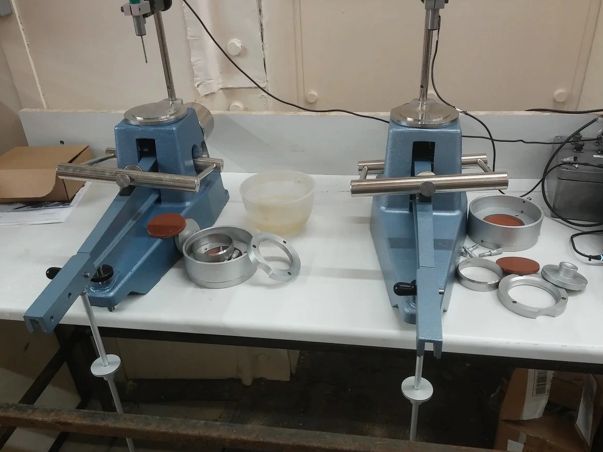
Atterberg Limits per ASTM D4318
Full liquid limit, plastic limit, and plasticity index determination on disturbed samples. We process material passing the No. 40 sieve and report the flow curve with 4-point data. Same-day and 24-hour turnaround options.
Combined Classification Package
Atterberg limits paired with sieve and hydrometer analysis for a complete USCS classification. Includes a summary table with PI, gradation curve, and group symbol for direct use in geotechnical reports.
Frequently asked questions
What does the plasticity index tell me about my Colorado Springs site?
The plasticity index — the numerical difference between the liquid limit and plastic limit — indicates how much water the soil can absorb before changing from a semisolid to a plastic state. Here in Colorado Springs, a PI under 10 generally means low shrink-swell risk; 10 to 25 suggests moderate movement potential; anything above 25 points to high-expansion clay that will require over-excavation, moisture conditioning, or a structural floor system. The number also controls the USCS group symbol your structural engineer uses for bearing capacity calculations.
How much does an Atterberg limits test cost?
How long does the lab take to report results?
Standard turnaround is 24 hours from sample drop-off. We also offer a 4-hour rush option for crews waiting on backfill approval or footing inspections. The test itself requires moisture conditioning and oven drying, so the timeline is mostly driven by the drying cycle. We email the certified PDF report directly to the geotechnical engineer of record.
Can I use Atterberg limits alone to classify my soil?
Atterberg limits give you the fine-grained classification — whether it's a lean clay (CL), fat clay (CH), or elastic silt (MH) — but they don't tell you the full story on grain size distribution. For a complete USCS classification, you need the limits plus a sieve analysis to determine the percentage of gravel, sand, and fines. We offer both as a combined package and recommend it for any project where the structural design depends on soil type.