Colorado Springs sits at over 6,000 feet against the Front Range, where the transition from mountain alluvium to Pierre Shale creates one of the most variable subsurface profiles in the Rocky Mountain region. Decomposed Pikes Peak granite weathers into micaceous silty sand that looks competent at the surface but can lose bearing capacity with depth. Our SPT program addresses this directly: we run continuous split-spoon sampling through overburden, counting blows every six inches and logging recovery, moisture, and color changes on the spot. The grain-size distribution from each spoon confirms whether fines content shifts into the 35-50% range where drained behavior changes significantly. We correlate N-values to relative density and undrained shear strength using local relationships calibrated for the Denver Basin formations, not generic textbook curves.
N60 values don't mean much without knowing what the hammer energy actually was. We calibrate every rig to ASTM D1586 energy ratio before it leaves the yard.
Technical details of the service in Colorado Springs
Risks and considerations in Colorado Springs
We investigated a five-story mixed-use structure off North Nevada Avenue where the developer's preliminary soil report assumed 3,000 psf bearing based on surface mapping of the Dawson Formation. Three SPT boreholes revealed a 9-foot layer of low-plasticity clay with N-values between 3 and 5 directly beneath the proposed footing elevation. The clay was not visible at the surface because 2-3 feet of imported fill from a nearby CDOT project had been placed years earlier. Had the building gone in on spread footings sized for 3,000 psf, differential settlement would have exceeded one inch across the column grid within the first two wet seasons. We recommended overexcavation and replacement with structural fill compacted to 95% modified Proctor density, verified by nuclear gauge testing every 12-inch lift. That recommendation came directly from SPT data collected at the right depth, with the right hammer energy, logged by someone who knows the difference between claystone fragments and truly weathered rock.
Our services
Our Colorado Springs SPT program integrates with the full geotechnical investigation workflow so you are not left chasing separate vendors for lab work, logging, or liquefaction analysis.
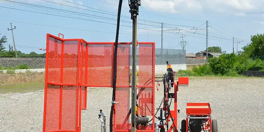
SPT with N60 Correction and Lab Index Testing
Drilling with automatic hammers, continuous split-spoon sampling, water-level monitoring, and in-house ISO 17025-accredited sieve and Atterberg limits on every sample. Logs include corrected N60, ER calibration data, and USCS classification.
Liquefaction Screening per NCEER Methodology
For sites within mapped liquefaction susceptibility zones along Fountain Creek and Monument Creek corridors. We apply Youd-Idriss (2001) procedures with NCEER corrections: fines content adjustment, overburden correction, and magnitude scaling factor for the 2,500-year event.
Frequently asked questions
What is the typical cost of an SPT investigation for a single-family home lot in Colorado Springs?
How does decomposed granite affect SPT blow counts versus actual bearing capacity?
Decomposed Pikes Peak granite often yields N-values above 50 in the upper weathered zone, but these high counts can be misleading. The grus may crush under sampler impact, producing a densified plug that inflates blow counts while the underlying material remains much looser along relict joint planes. We log recovery percentage and particle angularity to flag zones where N60 should be discounted.
Can you determine site class from SPT data alone?
Yes, for many sites SPT N60 values averaged over the top 100 feet provide the basis for Site Class D or C determination under ASCE 7-22 Table 20.3-1. Where refusal occurs above 100 feet on rock, we supplement with shear-wave velocity measurements from MASW to confirm a Site Class B boundary. IBC Section 1613.3.2 requires at least two independent methods when near a class boundary.
How soon after drilling can I get the borehole logs?
Field logs are available same-day, with final corrected logs and N60 values delivered within three to five business days after laboratory index testing is complete. For fast-track projects, we can provide preliminary SPT data in spreadsheet format within 24 hours of rig demobilization.