The drill rig sits at the crest of a cut slope off Highway 24, coring through weathered Pikes Peak granite while the engineering geologist logs fracture spacing and infill material. That is where every stability assessment in Colorado Springs begins: with the rock and soil itself, not with assumptions. Colorado Springs sits at the junction of the Great Plains and the Southern Rocky Mountains, a topographic boundary that creates some of the most variable slope conditions in the state. From the sandstone bluffs in Garden of the Gods to the colluvial deposits mantling the foothills west of I-25, each site demands its own friction angle, its own pore pressure model, and its own factor of safety. We run the analysis because the terrain does not negotiate. When weak claystone seams appear in the Dawson Formation or groundwater perches above weathered bedrock, the difference between a 1.3 and a 1.5 factor of safety can mean the difference between a stable subdivision and a landslide. Our team works with city geohazard reports, El Paso County grading permits, and CBR testing data where access roads cross the same slope units.
A slope that stood for ten thousand years can fail in ten minutes when pore pressure rises faster than the drain path can dissipate it.
Technical details of the service in Colorado Springs
Demonstration video
Risks and considerations in Colorado Springs
A developer cut a 40-foot near-vertical face into the Dawson Arkose on the west side of Colorado Springs for a hillside home pad, assuming the sandstone would stand up because it looked competent on the excavator bucket. First heavy rain season, water infiltrated along a claystone interbed that nobody mapped, pore pressure built up, and the whole face came down in a wedge failure that took out the foundation excavation and part of the access road. The repair cost more than the original earthwork budget. That sequence repeats itself across the Front Range every wet cycle. The risk is not just the slide itself: it is the downstream consequence. A slope failure above a cul-de-sac in a mountain subdivision can mobilize into a debris flow that reaches homes hundreds of feet below. Our analyses explicitly model the runout and consequence zone. When the city requires a geohazard report under the Pikes Peak Regional Building Department criteria, we include back-analysis of any existing failures on the parcel, because the slope has already told you where it wants to move. You just have to listen before you pour concrete.
Our services
Slope stability work in Colorado Springs spans residential lots, municipal infrastructure, and mining reclamation. We structure our analysis packages around the specific needs of the project.
Global Stability Analysis
Limit equilibrium modeling of natural and engineered slopes using Spencer and Morgenstern-Price methods. We include multiple groundwater scenarios and seismic loading cases per ASCE 7-22 for El Paso County.
Rock Slope Assessment
Kinematic analysis of structurally controlled failures in the Pikes Peak granite and Fountain Formation sandstone. Stereonet-based evaluation of wedge, planar, and toppling failure modes with field joint surveys.
Remedial Design Support
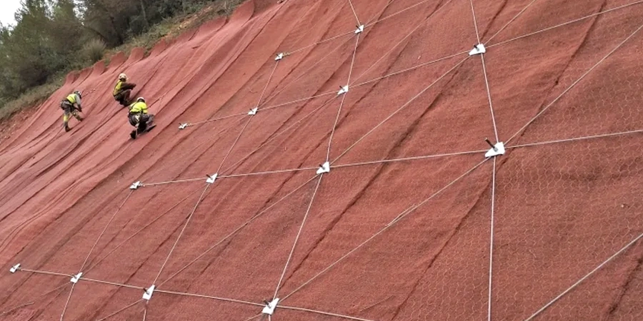
Stability analysis of reinforced slopes, soil nail walls, tieback anchors, and drainage improvements. We iterate the FoS calculation as the remediation geometry evolves.
Forensic Back-Analysis
Investigation and modeling of existing landslides and slope failures for litigation support, insurance claims, and repair design. We calibrate strength parameters to the observed failure geometry.
Frequently asked questions
What triggers slope failures in the Colorado Springs area?
Water is the primary trigger. Heavy summer thunderstorms, rapid snowmelt in the foothills, and landscape irrigation all raise pore water pressure in the soil and rock mass, reducing effective stress and shear strength. The Pierre Shale and Dawson Formation claystones are particularly sensitive to moisture. Freeze-thaw cycles in the winter also contribute to progressive weakening of near-surface materials.
How much does a slope stability analysis cost in Colorado Springs?
What information do you need to run a stability analysis?
We need site topography at a usable contour interval, subsurface data from borings or test pits with laboratory strength test results, groundwater level observations, and the proposed grading plan if the slope will be modified. For seismic analysis we pull the site class and mapped spectral accelerations from the ASCE 7 Hazard Tool for the specific coordinates.
What factor of safety is required by the city?
The Pikes Peak Regional Building Department generally follows IBC 2021 and local geohazard criteria, which require a minimum static factor of safety of 1.5 for permanent slopes. For pseudo-static seismic conditions a minimum FoS of 1.1 is typically accepted. Some hillside overlay zones have stricter requirements, so we verify the specific parcel regulations during the proposal phase.